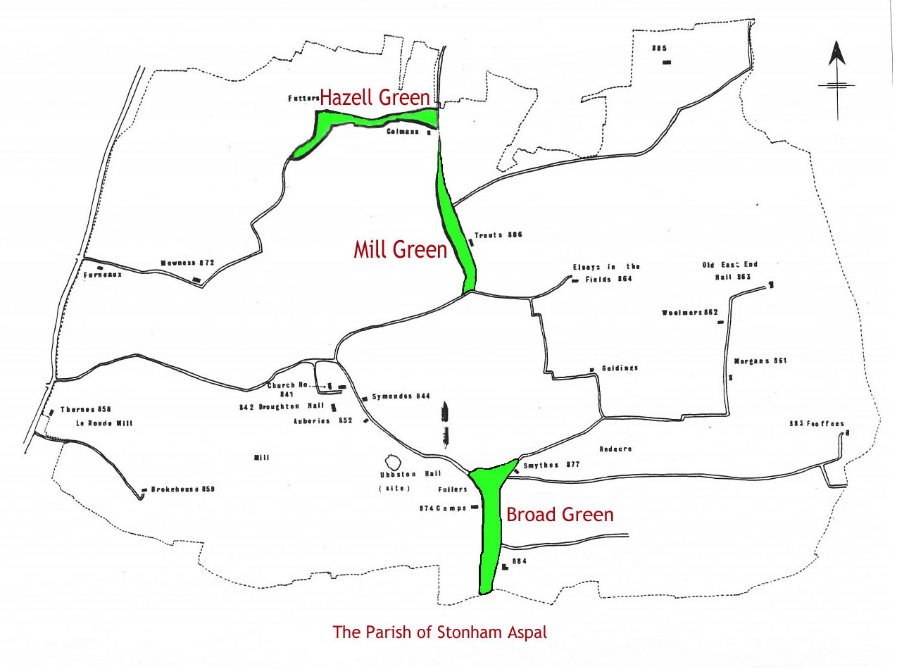
The map above is extracted from "The Houses Of Stonham Aspal: A Survey" by David Penrose, B. A. & Peter Hill, M. A. The date of 1971 is not printed on the report itself (it circulated locally and was never commercially published), but it is consistently cited in authoritative heritage listings:
- Suffolk Heritage Explorer cites it as: "The Houses of Stonham Aspal, Suffolk Review: Penrose and Hill, 1971."
- British Listed Buildings also cites: "The Houses of Stonham Aspal, Suffolk Review: Penrose and Hill, 1971."
It is an attempt at a reconstruction of the Village as it must have been in the middle of the 16th Century.
NOTE From Suzie: The colouring in is my own!
Stonham Aspal Parish
The settlement dates back to the Roman hypocaust period, and it was officially recorded as Estuna in the 1086 Domesday Book in the Bosmere Hundred of Suffolk.
The name of the Settlement changed from Estuna to Stonham Antegan in 1361
Now known as Stonham Aspal, it is mainly a ribbon developement along what was originally called the Earl Stonham Road and is now the A1120. It also encompassed:
- Hazell Green
- Mill Green (previously known as Wissing Green, Winson Green & Northern Green)
- Broad Green and Stonham Aspal Green (where Stonham Barns is now)
Today, only Mill Green is recognised as a Hamlet of Stonham Aspal.
1Citations
- [S299] Shirley M. Addy & Maureen Long, Suffolk Signs Book 2, Page 31.
- Stonham Aspal Parish Church
- Stonham Aspal Parish Records
- Stonham Aspal Village Sign
- Stonham Aspal Census's & Census Substitutes
- The People
- The Businesses
- The Mills
- The Manors and Farms
- Stonham Aspal Pubs
- Stonham Aspal Schools
- Stonham Aspal Village Hall
- Stonham Aspal Post Office
- Stonham Aspal Brass Band
- Stonham Aspal Charities
- Stonham Aspal in WW1 & WW2
- Stonham Aspal Home Guard
